topofusion
When I first used Google Maps, I was spellbound, but the novelty has worn off. It’s still extremely useful technology, but there’s a new technology that predates Google Maps that has caught my attention.
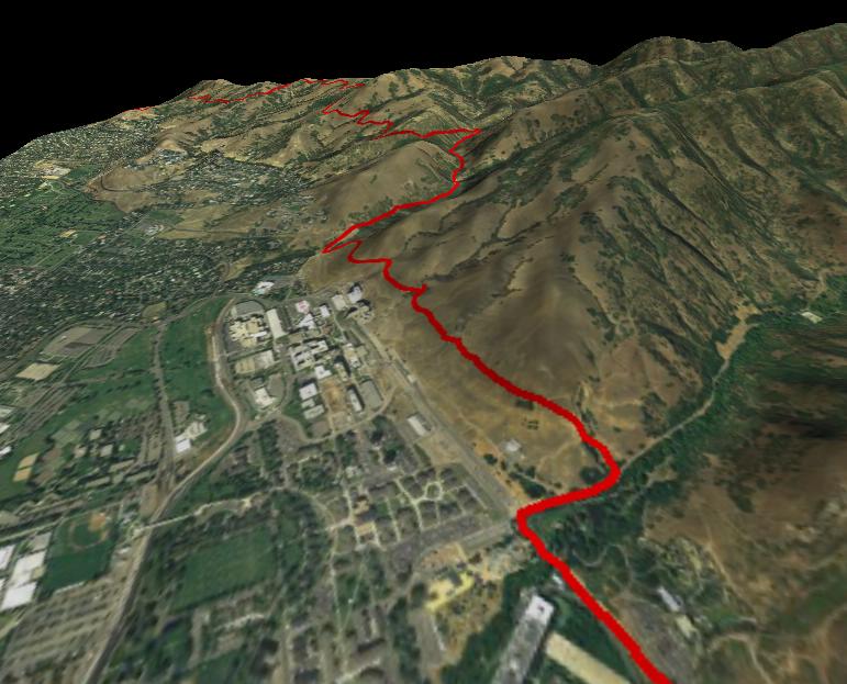
The technology is satellite and aerial photos of the United States, wrapped into a neat little package by a program called Topofusion. Using maps from TerraServer and OnEarth, you can see places in such detail that you feel as if you were hovering over them in a hot air balloon. Some of the color aerials have a 0.25 meter resolution, which gives you enough detail to see people and distinguish cars. You could even see the walruses sea lions at Fisherman’s Wharf. In addition, you can convert a region into a 3D rendering, allowing you to spin it around and look at it from any angle you want, to see the contours of the land.
Here is a screen shot to give you a taste, but it doesn’t do it justice. It’s great to be able to scroll around the city, seeing where you live and where you work. I even recognized some cars in our parking lot at work.
I’ve tried KeyHole, which is quite similar, but the resolution wasn’t as high (they only have down to 1 meter) so it wasn’t as impressive. I did like how it flew you around as if you were in a plane, but I liked Topofusion more.
You can download it for free, but it puts ‘Demo’ across certain boxes, making it hard to see that area, but it’s still fun to use. If you decide you want to get rid of the demo boxes, you can buy it for $40.
I would probably buy it if it ran on Linux, but it only runs on Windows, though I like it enough that I may still buy it. I think it’s cool to be able to see almost anywhere in the country from my desk.
How should I move to a specific city. I tried giving latitude and longitude in degrees but it’s always giving me an error.
I use the topographical map to find cities, or you can use this states.gpx file that will display an outline of the United States if you zoom out far enough.
has, I had that same problem and I finally got it to work after finessing it for a while. I think it didn’t like my degree symbols that I put in there.
umm dan those are sea lions not walruses, walruses have tusks.
Right you are. I know that, but it didn’t occur to me as I was searching for them. It explains why I had such a hard time finding pictures of them on Google.
I tour on my bike a lot and I love this program. The only thing that I wish for is the colored track for the grade of a climb. That way I could run a test track, add the dem data, and know if there is a climb that is too much.